Campbell Island View
Campbell Island
(New Zealand)
Location:
52° 33' south, 169° 09' east
  Campbell Island (New Zealand)
 
 
Geology

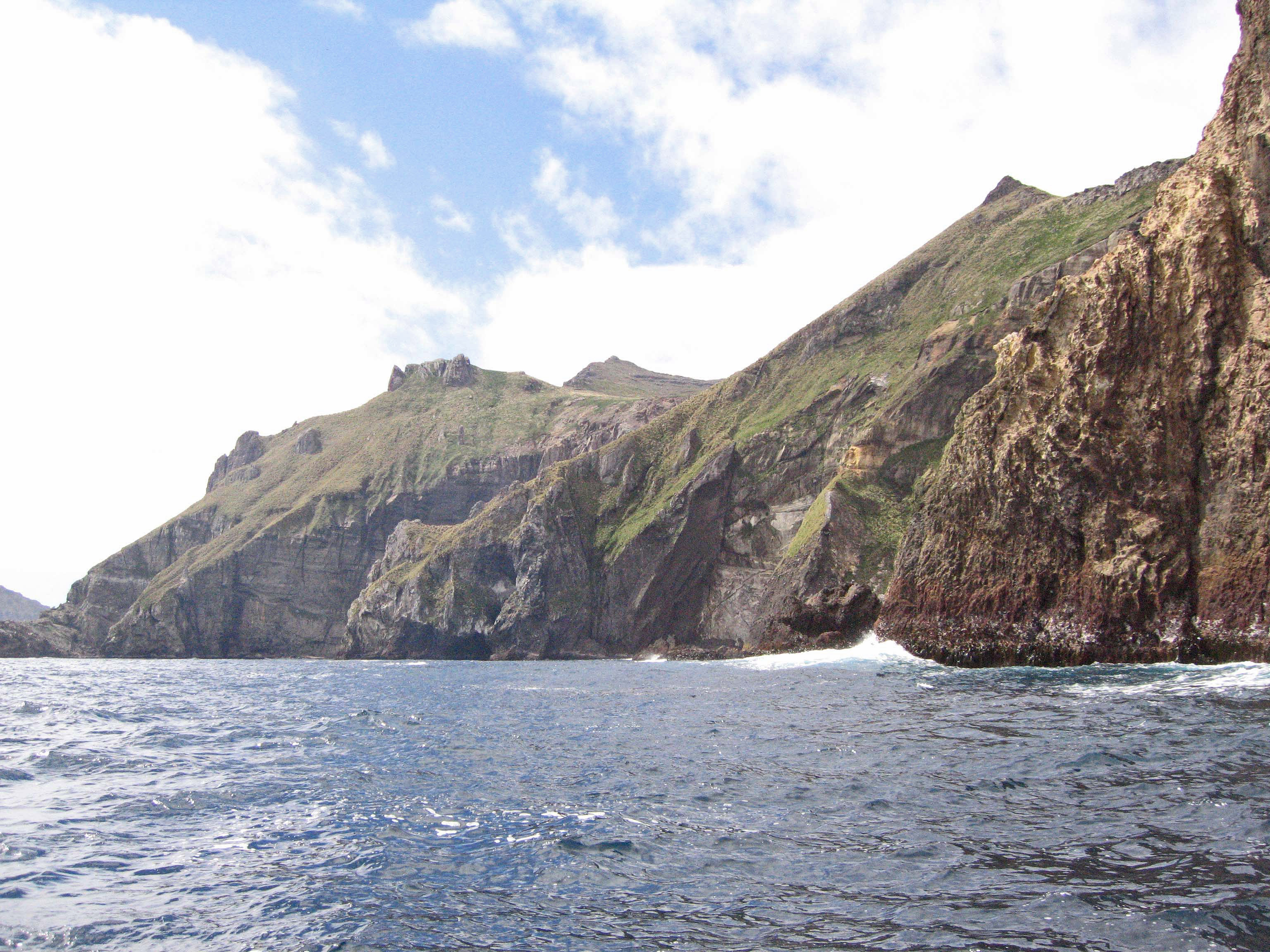
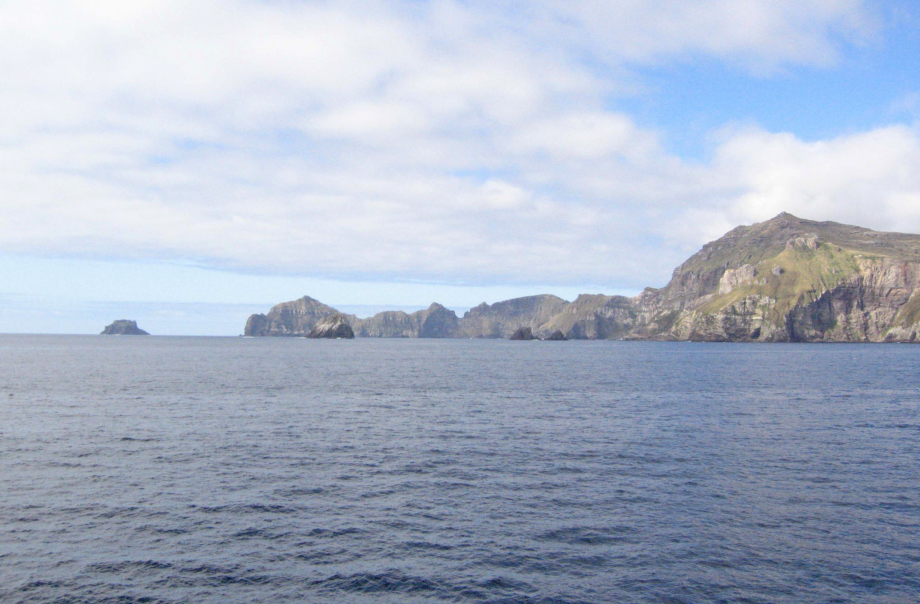
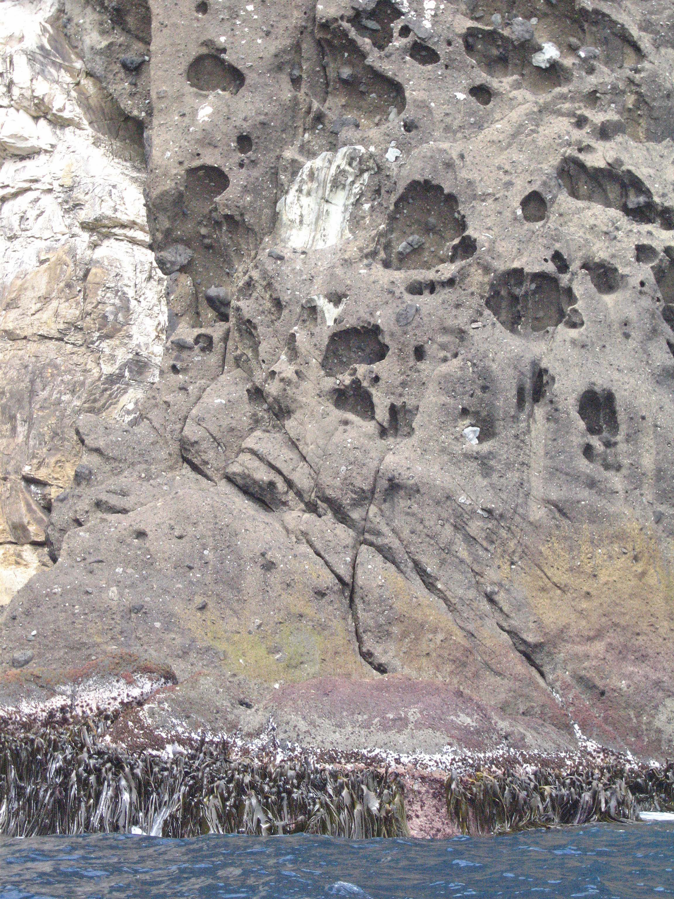
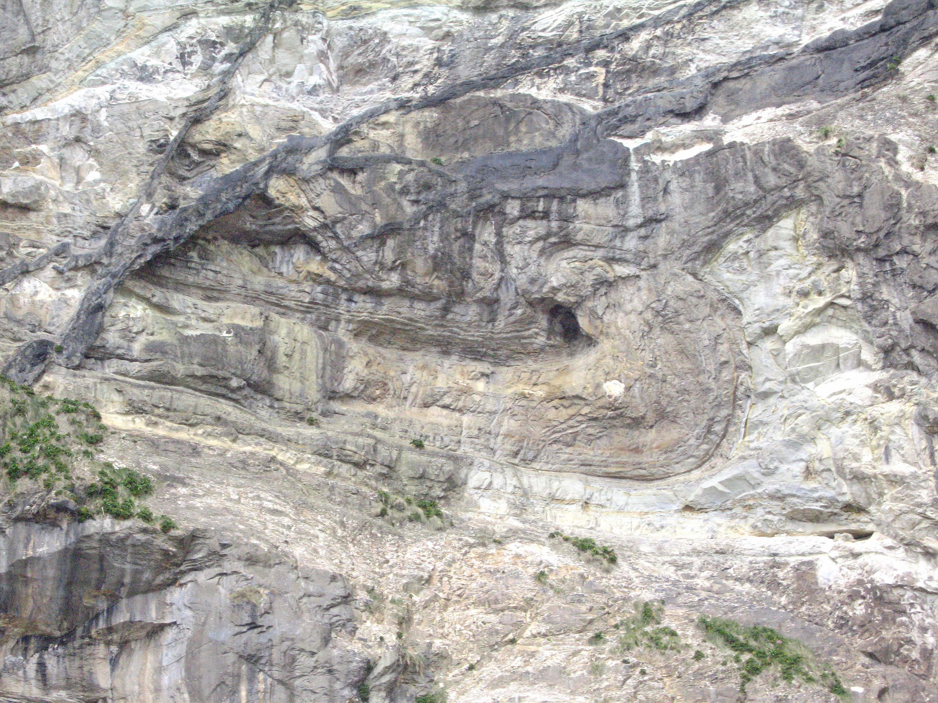
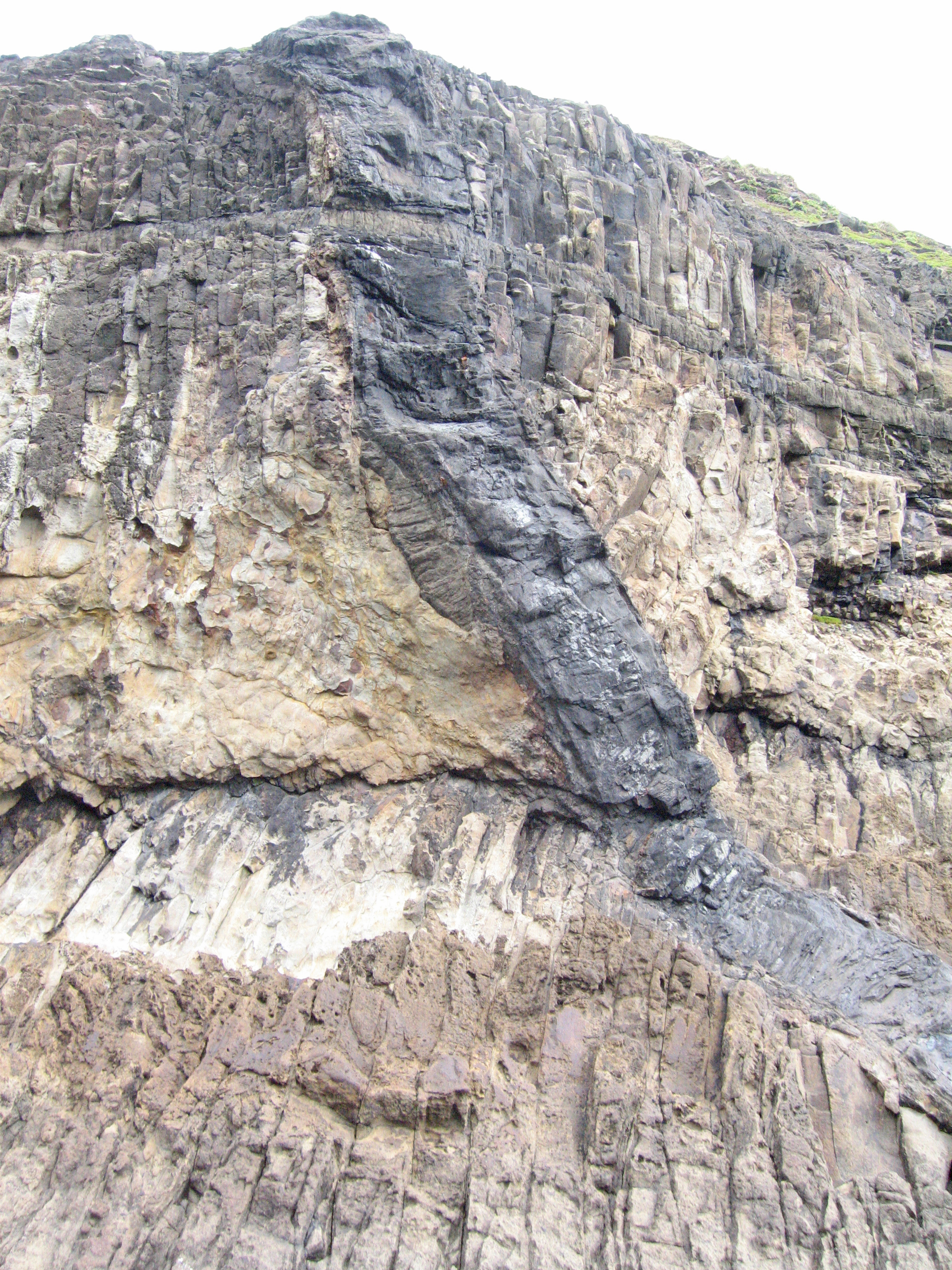
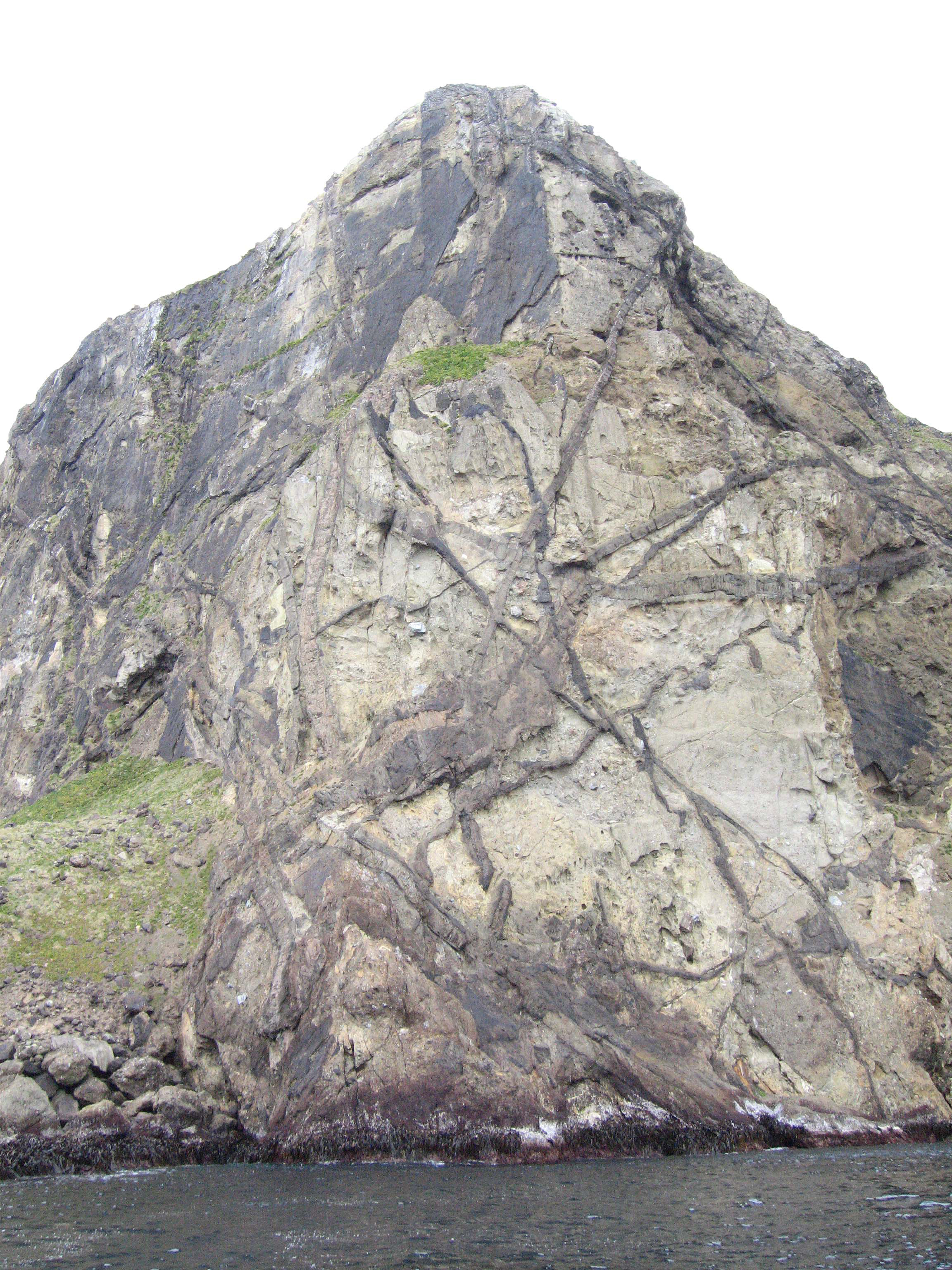
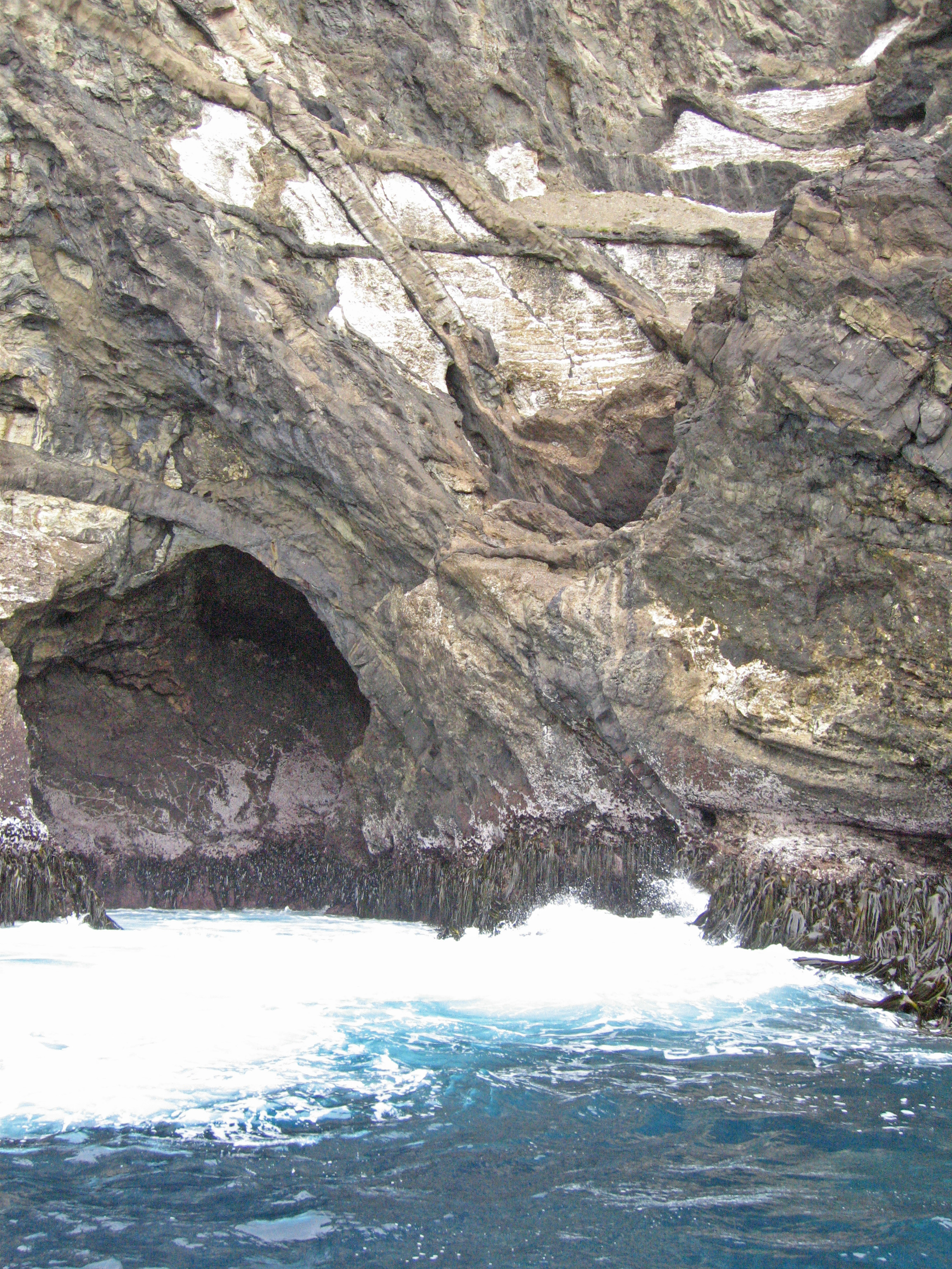
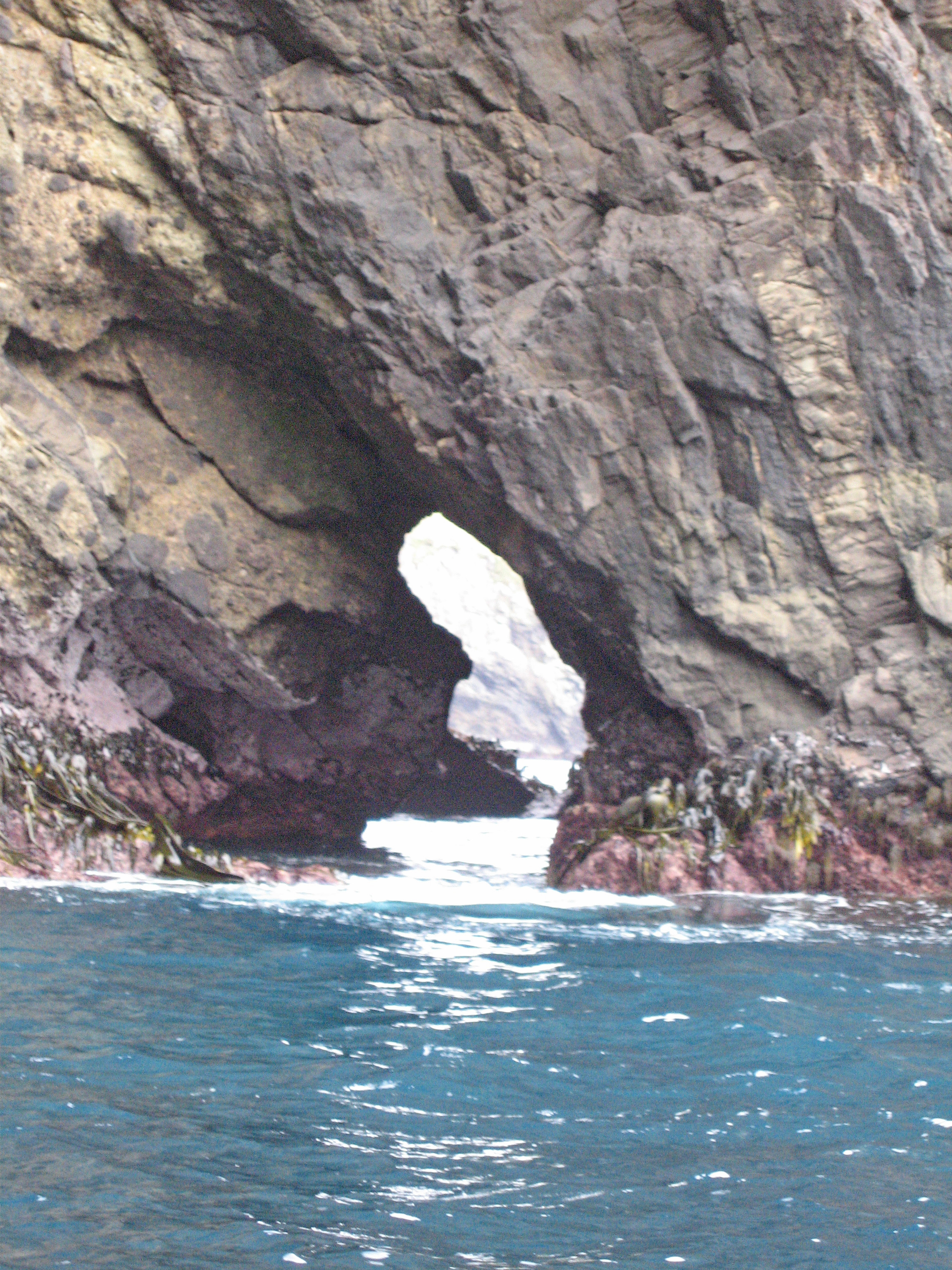
In striking contrast to Macquarie Island , Campbell Island is thought to have been formed, for the most part, by a shield volcano whose periodic eruptions covered about two-thirds of the surface. On the west coast, there are thick layers of ash with pyroclastic inclusions. Numerous basaltic dykes intrude into sedimentary rock. The west coast has high cliffs with numerous caves and arches formed by marine erosion. The effects of glaciation can be seen on the east side of the island.

Pyroclastic inclusions
More Info
View of Campbell Island
More Info
Cliffs on Campbell Island
More Info
Volcanic ash
More Info
Folded strata
More Info
Fractured basaltic sill
More Info
Basaltic intrusives
More Info
Basaltic intrusives
More Info
Basaltic intrusives
More Info
Arch along fault
More Info
Kelp
More Info
Volcanic plug remnant
More Info
Perseverance Harbor
More Info


Expedition Nov. 24 – 29, 2005
Text and Layout by Peter S. Goltra and Gail W. Goltra
with Identification and Consultation by
Peter Harrison, Geoff Renner and Geoff Walls.
Photographs by Peter Goltra and Jean Halford
Bird Calls Courtesy of Les McPherson
Web Design and Development by HindSite Interactive, Inc.